

The Pilotage Digital Project

The Pilotage Returns Project explores the movement of ships to and from Dublin Port through the transcription, structuring and visualisation of historical pilotage returns.
Pilotage is a core maritime operation within the functioning of a port. It is a regulated system for guiding ships safely into and out of harbour areas. Under maritime legislation, ports are designated as pilotage districts, within which only licensed pilots are authorised to operate. These pilots are examined and certified by the port authority and provide navigation guidance during arrival and departure, drawing on detailed knowledge of local conditions.
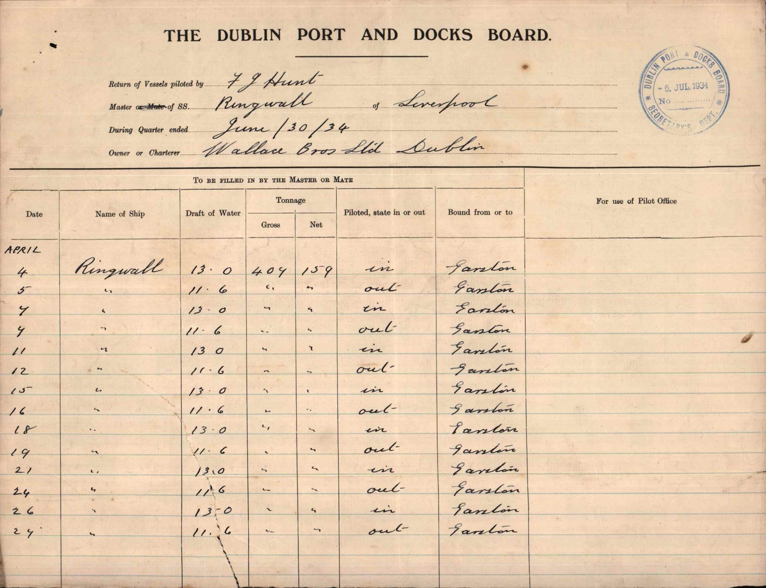
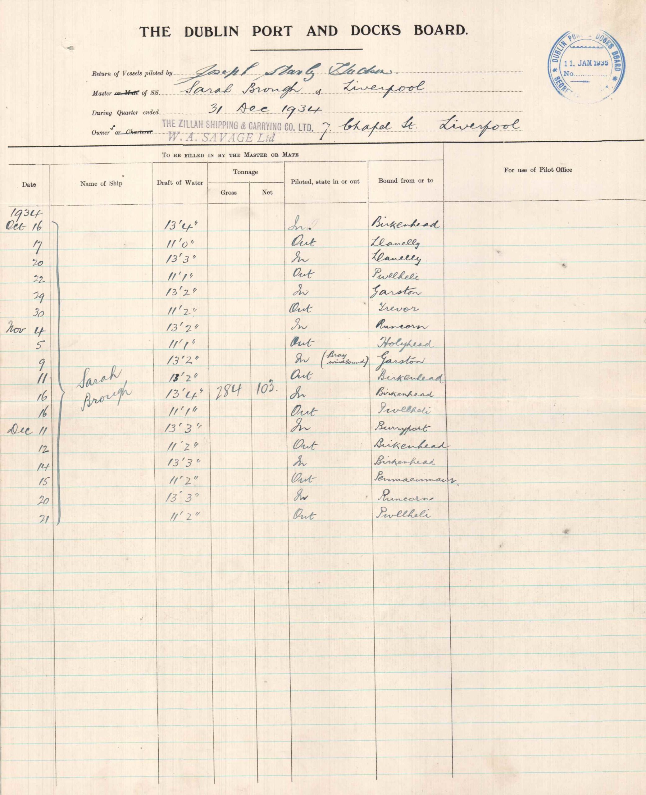
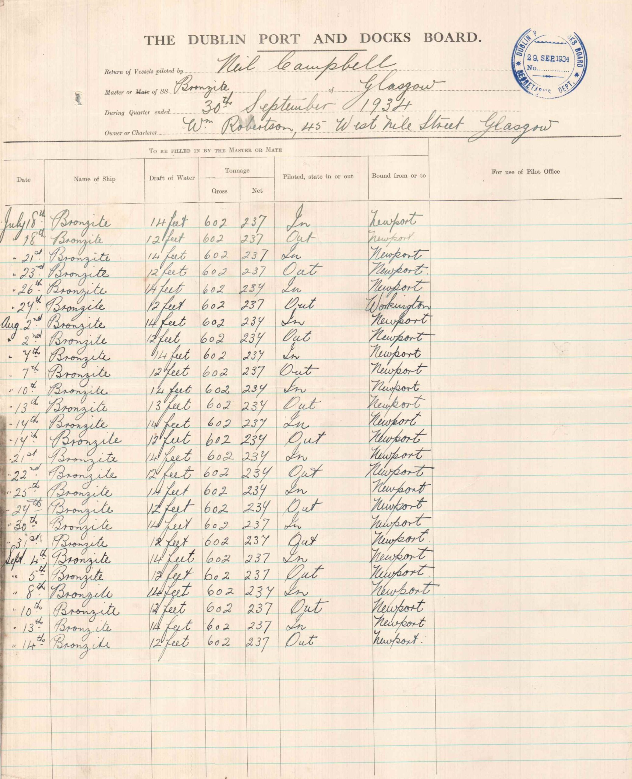
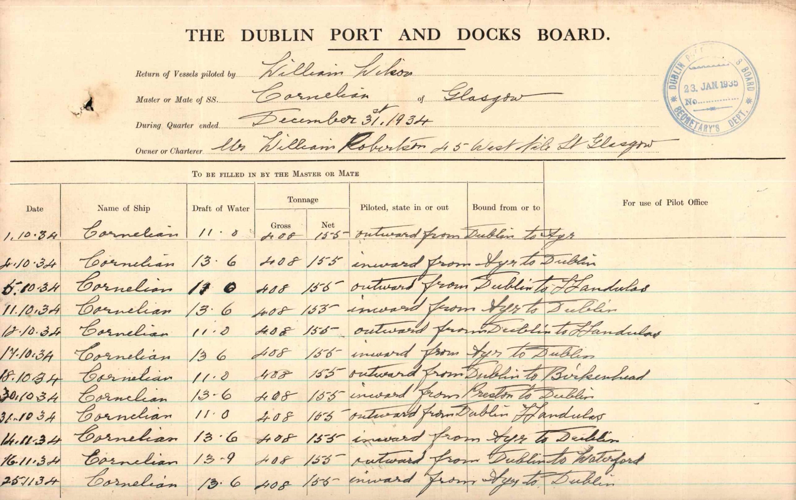
The pilotage returns used in this project were submitted by shipping companies operating at Dublin Port. These records document vessel movements on a regular basis and include details such as ship name, routes, tonnage, and the pilot involved in each movement. In this context, pilots appear within company records as part of the operational activity of each voyage.
It is important to distinguish how the term “pilot” is used. In port operations, a pilot is a navigator working within the port system, responsible for guiding vessels safely through the harbour and its approaches. These pilots are not attached to a specific ship, but operate across the port, assisting vessels as required. In the returns presented here, pilots are recorded within company-submitted documentation of vessel movements, reflecting the administrative practice of recording shipping activity at company level. The term therefore appears in a different documentary context, even though it refers to the same navigational function within the port.
This role is particularly important in ports such as Dublin, where safe navigation depends on more than open water. Access to the port has historically relied on engineered infrastructure and continuous management, including the construction of harbour walls, the marking and dredging of channels, and the use of navigational aids such as lights and buoys. Pilotage operates within this environment as part of a wider system that enables vessels to enter, move within, and leave the port safely.
Each return documents a specific movement, including the date, vessel name, pilot, port of origin or destination, direction of travel, and tonnage. While administrative in form, these records capture the day-to-day management of maritime traffic and the interaction between ships, pilots and port infrastructure.
As part of this project, a selection of returns from 1934 has been transcribed and organised into a structured database. This process transforms handwritten archival material into searchable data, enabling the records to be explored in new ways.
The dataset has been used to create an interactive map that visualises shipping routes. Each line represents a recorded journey, connecting Dublin with other ports. The map includes a timeline animation set to a daily interval, allowing users to follow movements chronologically across the year. The interval can be adjusted using the timeline controls to change the speed and scale of the animation. Users can also zoom in and out of the map, navigate between regions, and apply filters to explore the data by ship, pilot, route and direction of travel.
Together, the database and map allow the material to be explored at different levels: as individual records, as repeated routes, and as a wider network of connections. In this way, the project shifts the focus from isolated entries to patterns of movement and the operational systems that underpin them.
The database is structured from the information recorded in the pilotage returns. Each entry corresponds to a single vessel movement and includes the following fields:
- Date – the recorded date of the vessel’s movement
- Ship name – the name of the vessel
- Pilot – the name of the pilot recorded for that movement
- Movement – indicates whether the vessel was arriving to or departing from Dublin
- Port of origin / destination – the port from which the vessel arrived or to which it was bound
- Gross and net tonnage – measures of the vessel’s internal volume rather than its weight. These values give an indication of the vessel’s overall size and carrying capacity.
- Gross tonnage refers to the total enclosed space within the ship, including cargo holds, engine rooms, and all internal areas.
- Net tonnage represents the space available for carrying cargo or passengers, excluding areas used for the ship’s operation such as machinery and crew spaces.
- Draft – the depth of the vessel below the waterline, relevant for navigating port channels
At present, the dataset includes returns for 1934 only. This initial phase focuses on material relating to William Robertson Ltd and Zillah Shipping, providing a pilot dataset for the project.
The database will continue to expand as more pilotage returns are identified and processed within the Dublin Port Archive. As additional material is incorporated, the project will support a more detailed understanding of how ships, pilots, companies and routes connected Dublin Port to wider maritime networks over time.
H.A. Gilligan, A History of the Port of Dublin (Dublin: Gill and Macmillan, 1988).
Pilotage Act 1913, 3 & 4 Geo. 5 c. 31 (1913).


Port Stories


Related Collections

Help us with the Archive
You can help us to preserve Dublin Port’s rich archival heritage by
donating items or seek advice from us on items in your safekeeping.
Get in touch by completing the contact form below.
We’d love to hear from you!
