

The consolidation of cartography and map-making as institutionalised disciplines culminated throughout the 18th century. Indeed the term cartography was coined c. 1830 and maps become universal. Map-making practices became standardised in the 1880s and the prime meridian was placed at Greenwich as the international standard reference for cartographers.
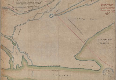
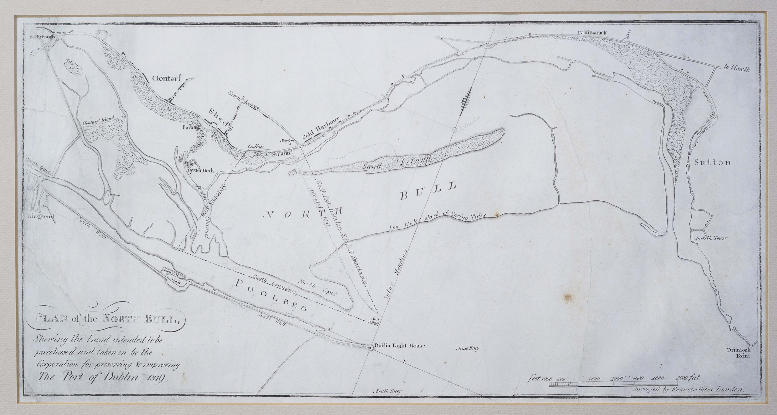
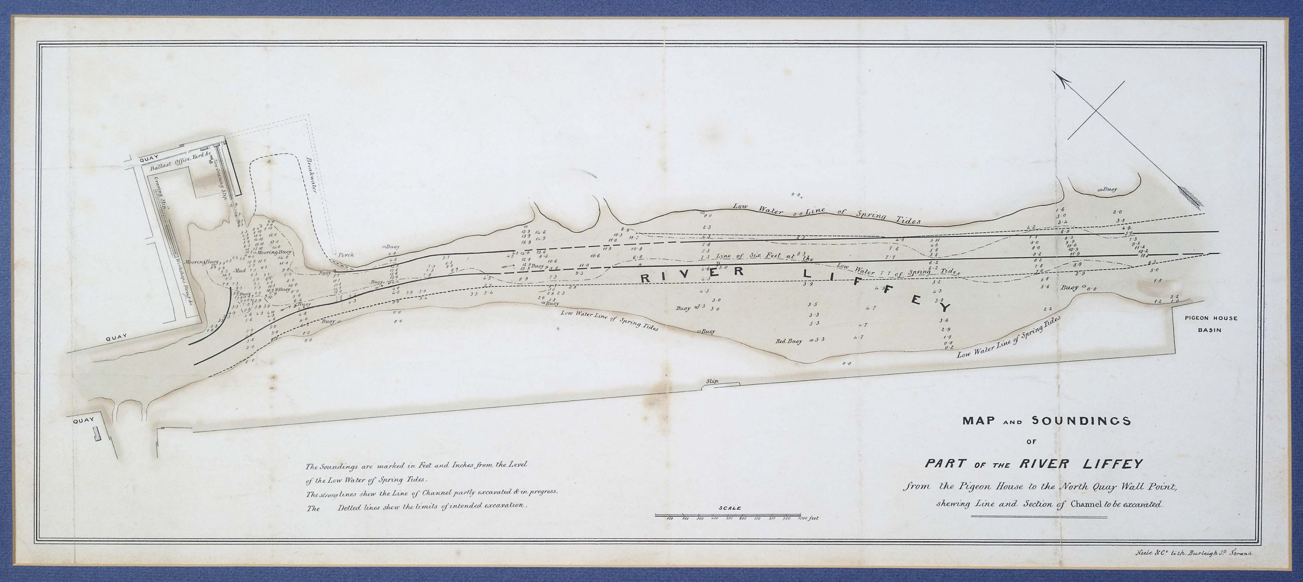
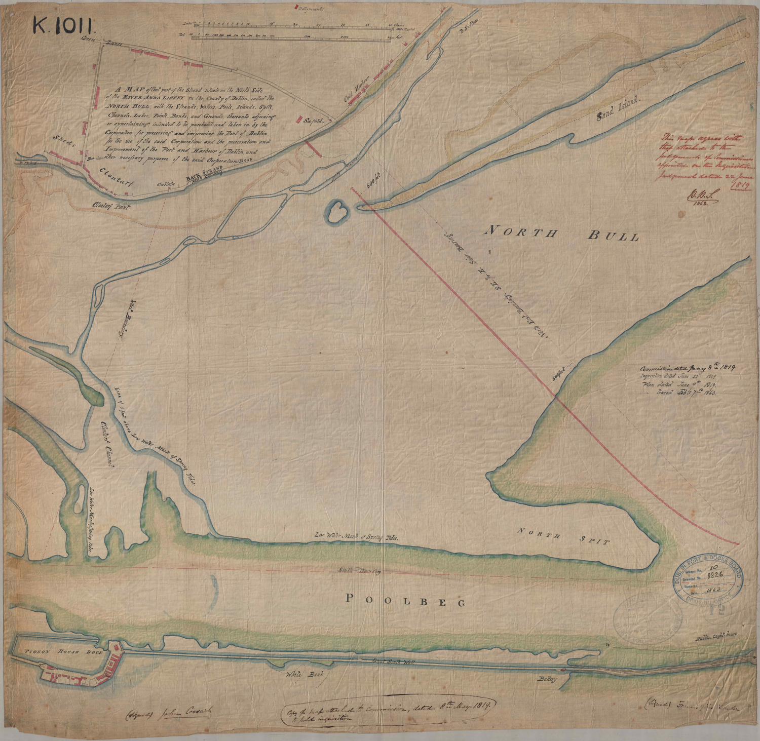
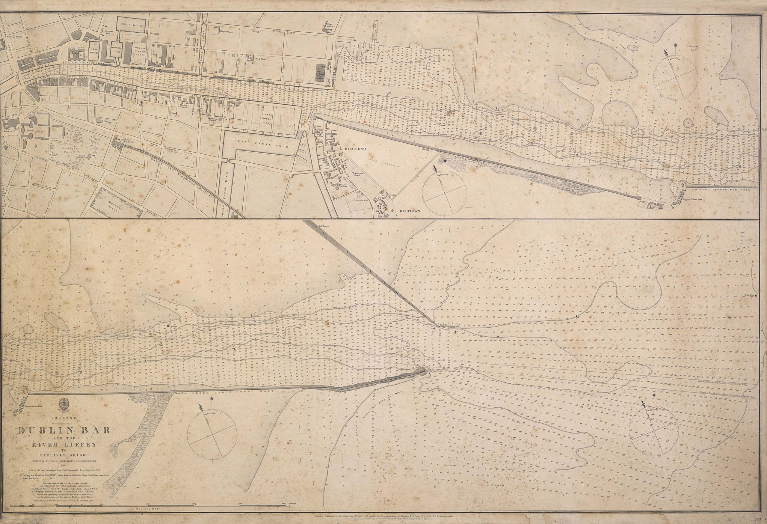
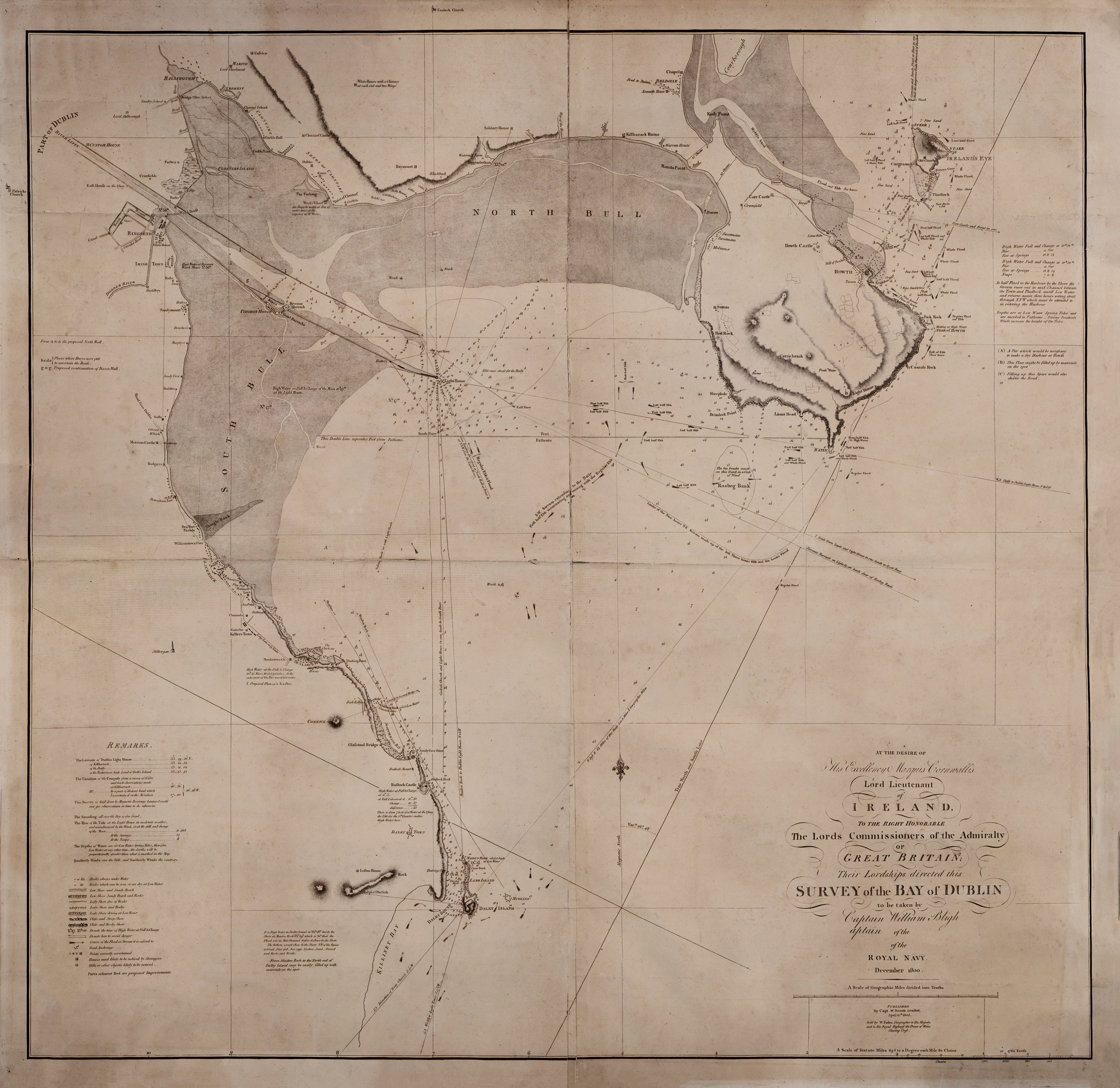
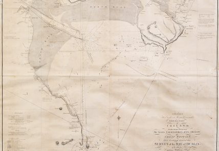
For the history of Dublin, the most relevant 18th-century maps preserved by Dublin Port Archive are undoubtedly the ones produced by Capt. William Bligh and Francis Giles. Both proposed the building of the North Bull Wall. In the city’s collective imaginary, Bligh designed the wall that prevented the sand to accumulate in the channel forming Bull Island. However, the wall Bligh devised and the wall we know today are not the same. Francis Giles and George Halpin C.E were its creators. Bligh’s wall was to run parallel to Great South Wall but Giles and Halpin took another approach to avoid the huge pressure of a body of water trapped in such a narrow open. They further designed the last part of the wall to be built at half of the height as a form of release valve, allowing water to escape.


Related Articles
Help us with the Archive
You can help us to preserve Dublin Port’s rich archival heritage by
donating items or seek advice from us on items in your safekeeping.
Get in touch by completing the contact form below.
We’d love to hear from you!
