

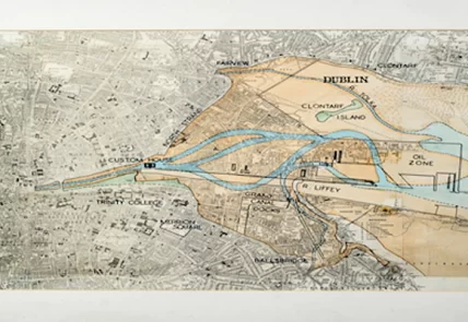
Throughout the 16th and 17th centuries, Dutch mapmakers mastered the art of cartography. They turned maps into artworks and scientific tools resulting in a very profitable business. In the 1800s mapmaking, the scientific methodology and the idea of correctness began to have greater importance. Mapmaking was the result of science, based on fieldwork and empiricism: math’s, geodesic calculus and topographic representations which were greatly influenced by technological process and consolidation of scientific institutions.
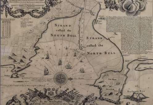
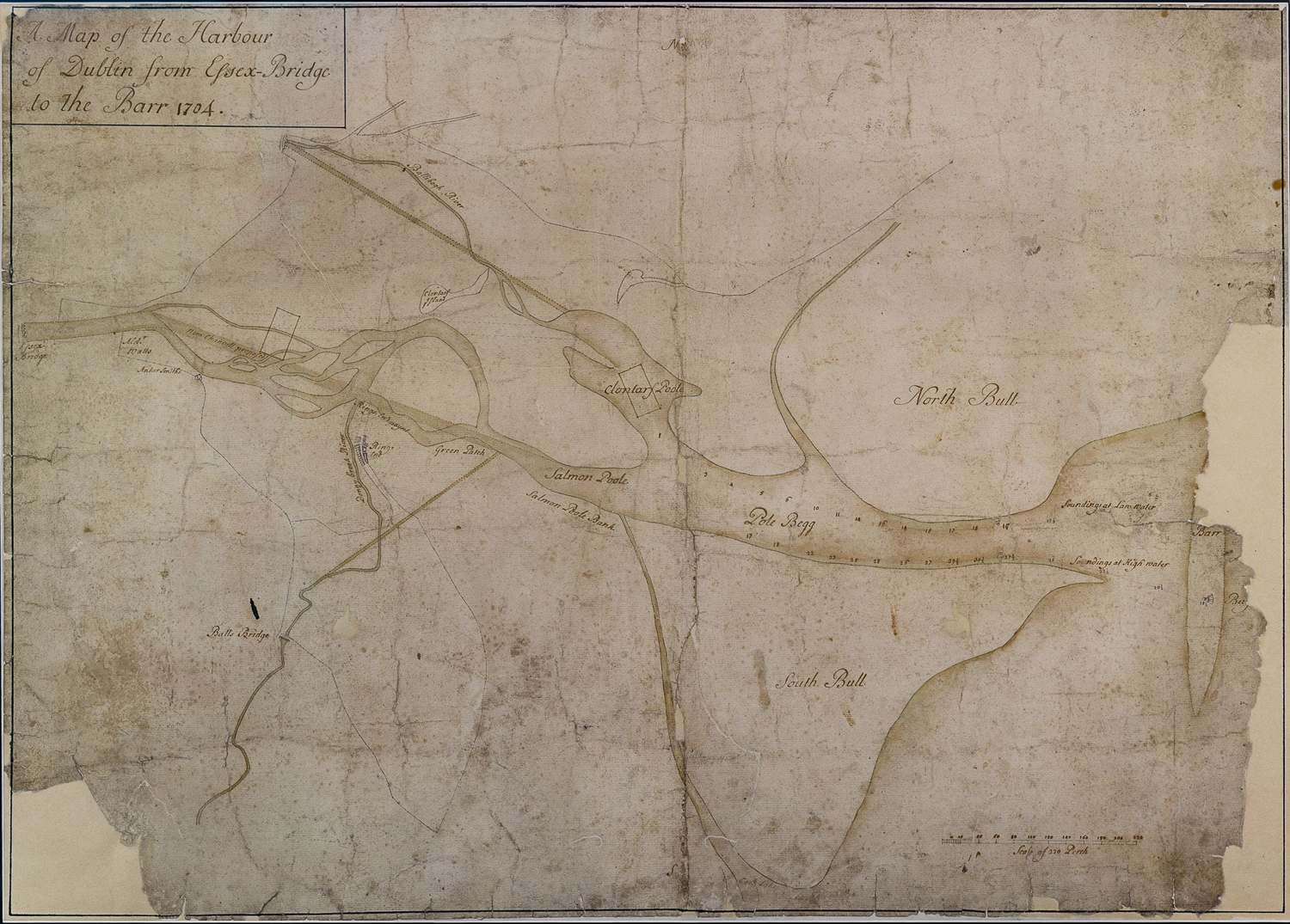
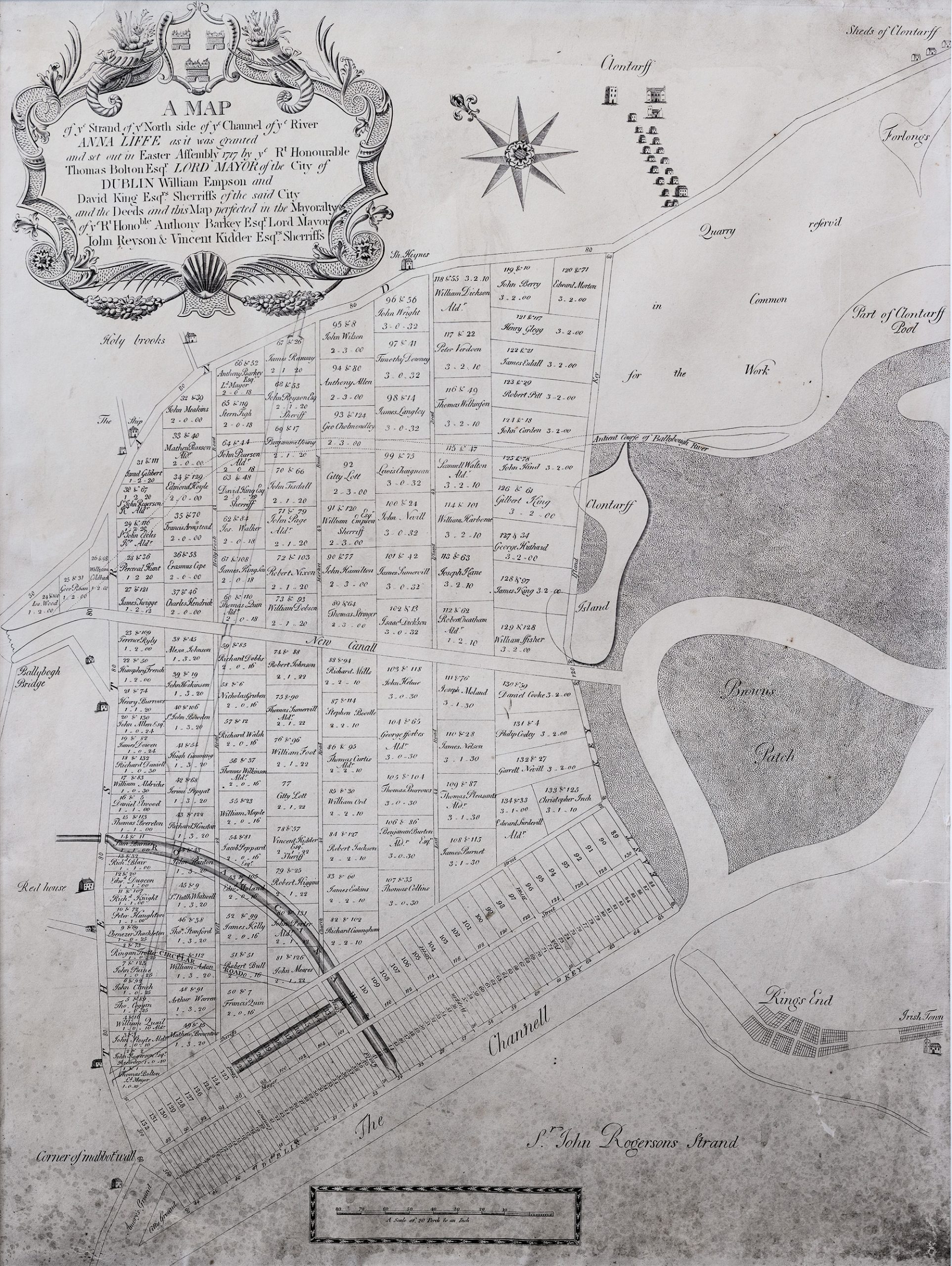
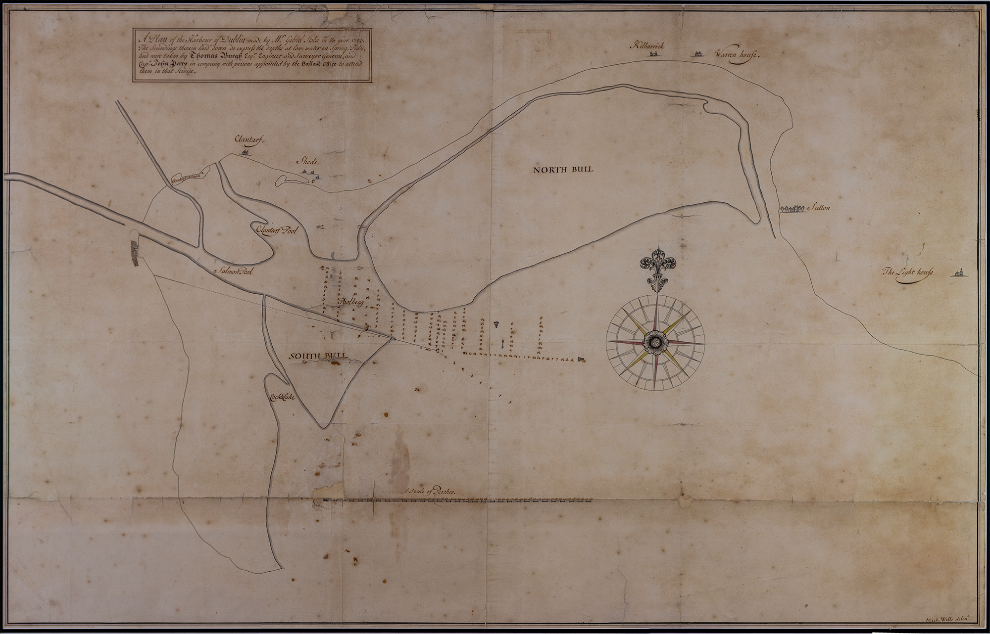
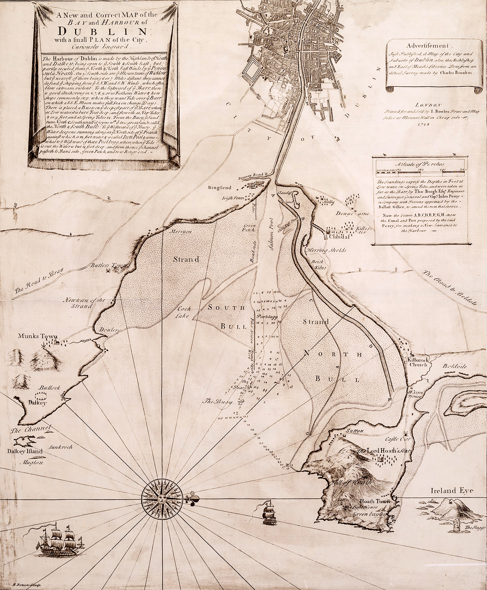
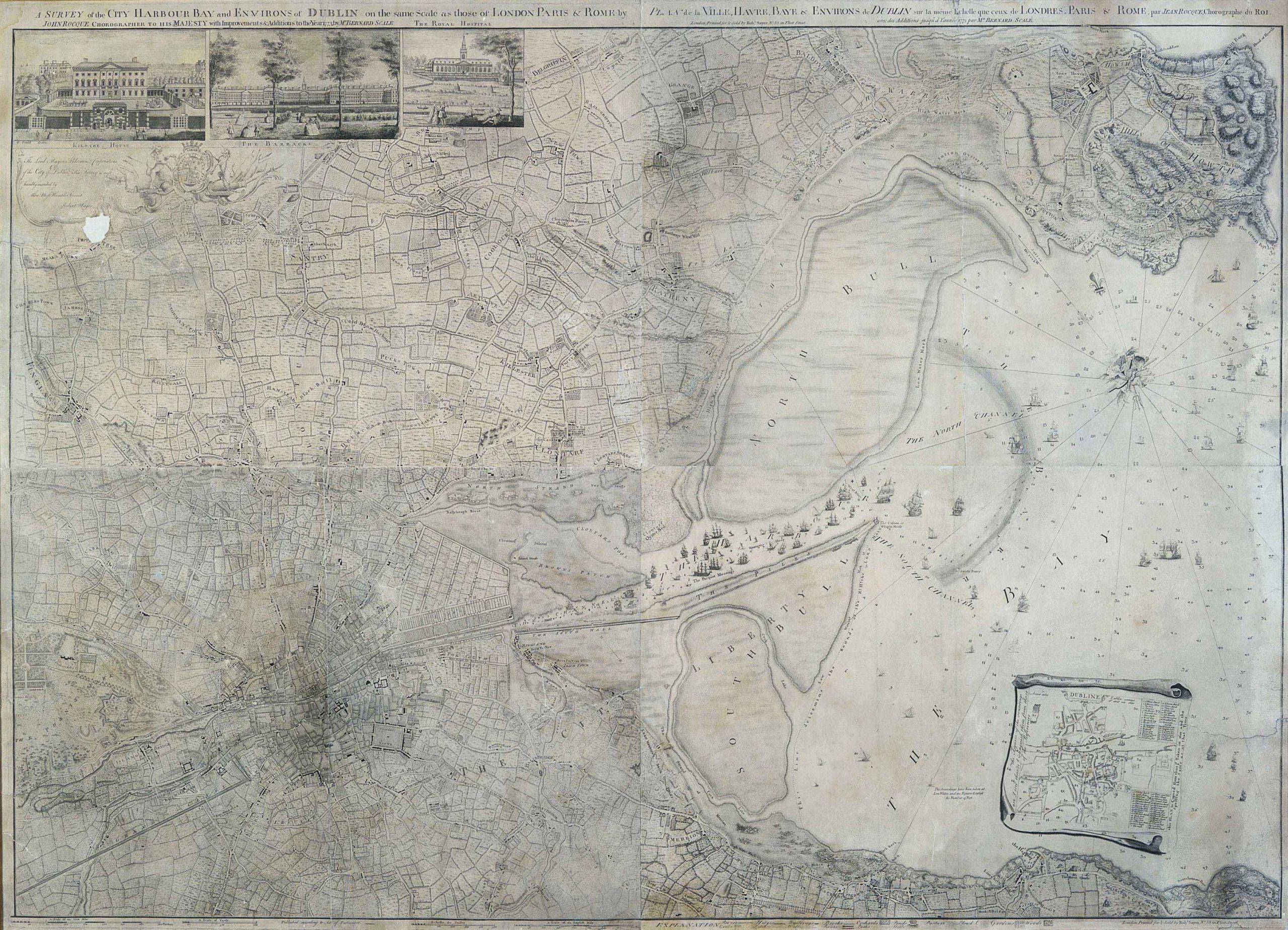
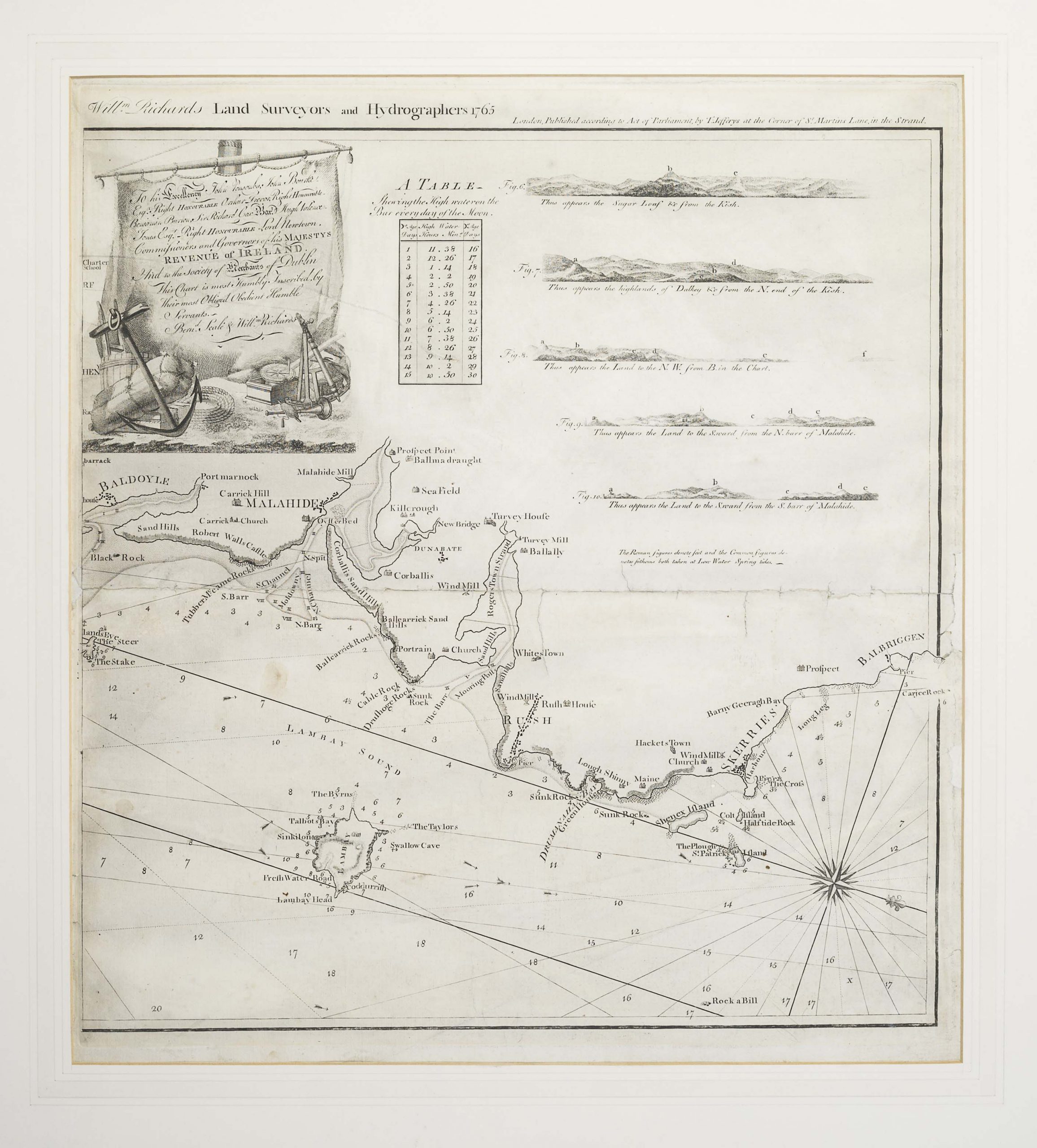
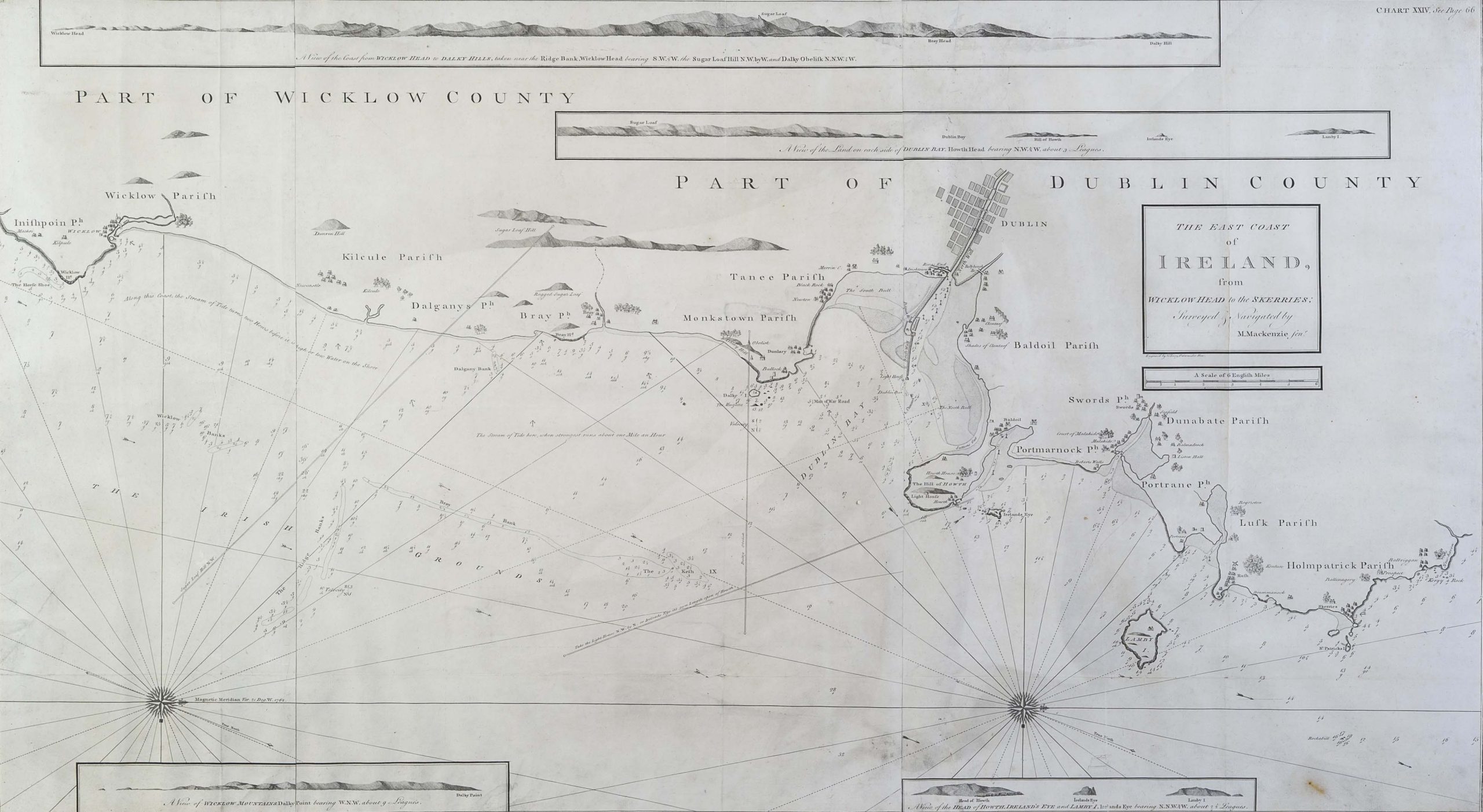
The maps in this collection offer an insight into mapmaking in Dublin and they embody the different aspects of mapmaking listed. Some are quite technical, like the 1704 map of the Harbour of Dublin from Essex Bridge to the Barr, which presents the state of the bay and proposed developments for its improvement, or Stokes 1725 map, which provides the depths of water at the bay channel. Others did not only utilise science but also a style of art, like Gibson or Rocque. Gibson’s map is a clear example, employing resection and intersection surveying techniques combined with a profound rococo style decoration.


Related Articles
Help us with the Archive
You can help us to preserve Dublin Port’s rich archival heritage by
donating items or seek advice from us on items in your safekeeping.
Get in touch by completing the contact form below.
We’d love to hear from you!
